

Coromandel Fun Maps
Tait’s Fun Maps – The Coromandel’s most popular brochures!
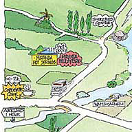
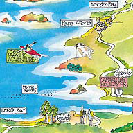
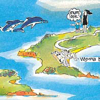
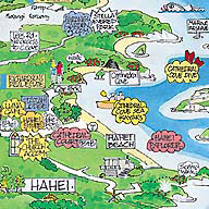
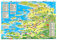
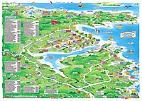
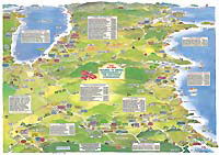
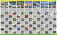
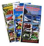 The well known and popular Tait's Coromandel Fun Maps give a unique view of the Coromandel Peninsula as a holiday destination. At a glance the maps show all the highlights of each of the three regions as well as places to stay, fun things to see and do, cafes & bars, and more. The visitor guide information, highlight photos and contact details of the advertisers appears on the back of the maps.
You can pick up copies of the three Fun Maps at most advertisers or the i-Site Information Centres around the Peninsula or in Auckland, Tauranga, Rotorua, Hamilton, Devonport, Takapuna, Franklin County, etc.
To have a set of the Fun Maps posted to you send us a request from the contact page.
Download the Fun Maps For a Virtual Tour of the Coromandel Peninsula
Download the full size maps and scroll around the region on your computer to plan your Coromandel holiday.
Use the Fun Maps in conjunction with the advertisements and visitor guides on this website, and Peter Tait's CoroGuide.
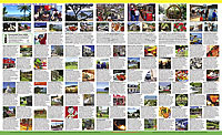
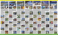
Visitor Guide and Photo Ads
Download the illustrated Visitor Guide and large spread of photo ads from the back of the Fun Maps. The 'F M Bs' (Fun Map Backs) will help you plan your Unforgettable Coromandel Holiday.
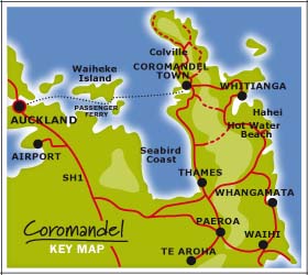
NOTE - The Fun Maps are not to scale but are still helpful for finding your way. For accurate distances, driving times and locating secondary streets refer to a conventional road map.
DON'T use the Fun Maps for navigation on the water.
PLEASE NOTE
In preparing this website we have taken special care in describing the special characteristics of the region, the natural beauty, the friendly locals, the history and the environment. Throughout it is emphasised that this is a unique region – enjoy it to the max, but at the same time, it must be respected, protected and not over commercialised.
Te Whenua te wai u mo nga tamariki. (Land is the nourishment for the next generation.)